The landslide in Tarsin, Darfur
2 September 2025
A landslide completely covered the village of Tarsin, east of Jebel Marra in Sudan’s Darfur region, on Saturday night. The exact death toll from the incident in this remote area, nestled in a mountain range, is unknown, as communications and the internet have been cut off.
According to a resident of the village who lives outside the town, the village had about 30 houses in 2016, but its population increased after people displaced by the current war in Sudan arrived.
This is the second incident of this kind in Darfur in recent years, following a similar land issue in 2018 when a landslide hit the Turba area, killing and wounding hundreds.
The civilian authority of the Sudan Liberation Army, led by Abdul Wahid Mohamed Nour, mourned the residents of Tarsin village, stating that all but one survivor had died. In a press release, the authorities appealed to the United Nations and regional and international organisations to help them recover bodies from the ground.
For his part, Adam Rijal, spokesman for the General Coordination for Displaced Persons and Refugees in Sudan, appealed in a press statement on Tuesday to the international community to take immediate action to assist the residents of the Tarsin area.
Night disaster
A landslide struck the village of Tarsin on the night of Saturday, August 30, covering homes in the area with dirt and rocks. All residents died, with one survivor in poor health, according to Fathi al-Rahman Ali Muhammad, a resident of the village whose father died in the incident.
“I learnt of my father’s death two days later. They told me that everyone had died and that my uncle, Maqbool Ibrahim, had survived but had sustained severe injuries,” al-Rahman said. “Both of his legs were broken, and he had suffered a blow to the head and was completely unconscious.”
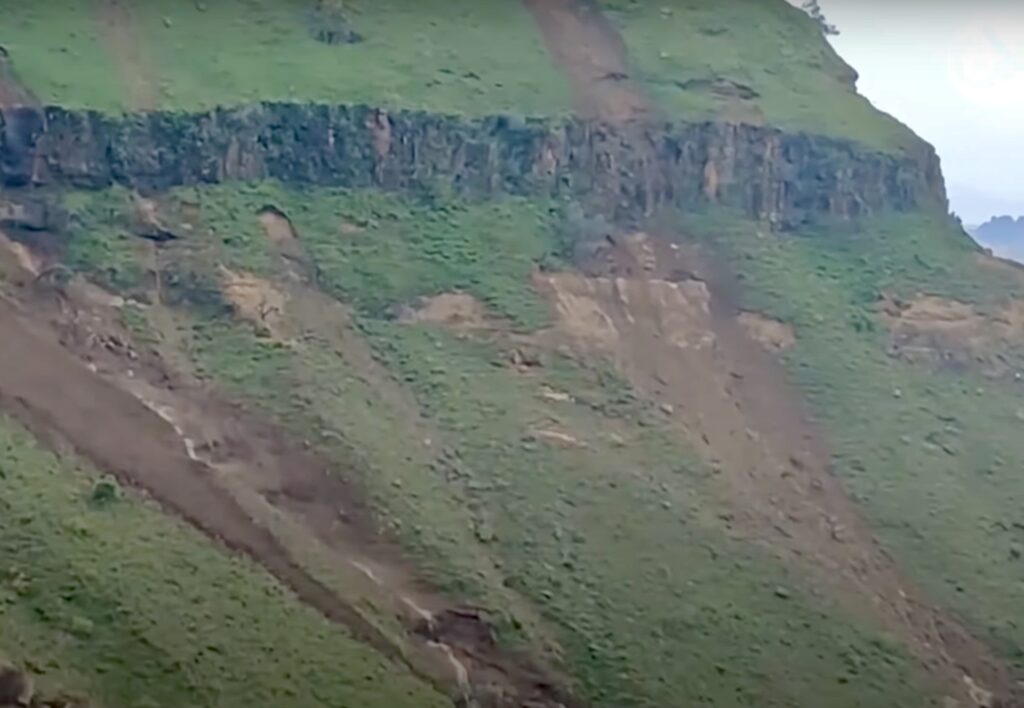
Al-Rahman recalls that the landslide occurred one and a half kilometres from him. “From the highest peak of the mountains, it was as if the earth had been cut with a knife. Rocks and soil swept toward homes in slightly lower areas, completely covering them while their occupants slept,” he described.
Al-Rahman says his mother and the rest of his family live in another area, while his father insisted on staying in the village he founded so he could be close to his farm and work there.
Climate change
Fathi al-Rahman believes the earthquake that caused the landslide was due to noticeable changes in the area’s environment. “Years ago, we used to herd sheep and climb mountains with difficulty because the entire area was covered in water. Everywhere you set foot, you’d find stagnant water that could make you fall,” he says. “However, over the past few years, I’ve spoken with my friends there, and they told me they can’t reach many places in the area because the soil has become more fragile and uncohesive than before. They’re constantly falling, which reflects the magnitude of these changes.”
According to al-Rahman, the changes in soil place nearly 100 small villages east of Jebel Marra, nestled amidst the plains and highlands, at severe risk. “We, the people of the region, are planning a campaign to relocate the villages at risk to safer areas to avoid a repeat of what happened in Tarsin.”
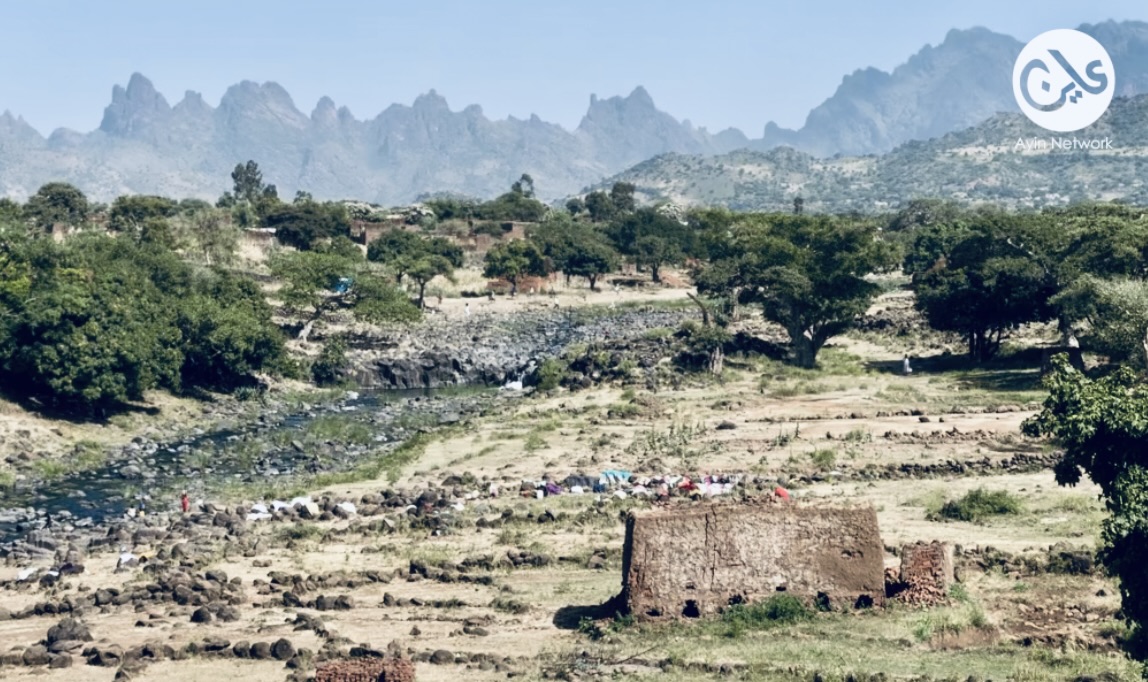
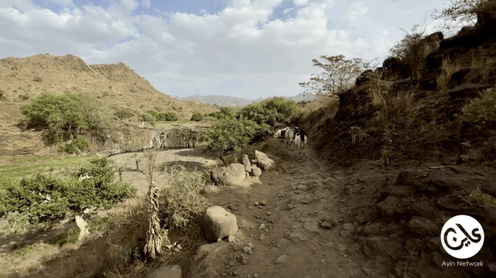
The village of Tarsin is located in the middle of a mountain range east of Jebel Marra. Access is challenging – donkeys are the sole means of transport; the nearest area accessible by car is a town called Tribat. It takes about six hours to reach Tasin via donkey. It was named Tarsin because of its nature, as this word in the Fur language means that a person must place their feet firmly when moving so as not to fall, according to Fath al-Rahman.
Originally a village for about 30 fruit farmers, Tarsin’s population expanded after the war as displaced people moved in, according to Al-Rahman.
A devastating alarm bell
“What happened in the village of Tarsin is frightening and highly dangerous in an area that lacks monitoring, first aid and emergency equipment,” geoscience expert Abdul Karim Al-Amin told Ayin. “The Jebel Marra region is known for its volcanic rocks, some of which are active and others are dormant. According to Al-Amin, the Jebel Marra region is 10,000 feet above sea level and rests on a mass of volcanic rocks. The volcanic activity beneath the earth’s surface makes the area particularly precarious, he added.
“In the recent past, we have witnessed ground cracks and soil fissures near the Banbusa area in West Kordofan State. Despite its relative distance from Jebel Marra, those scientifically interested in the movement of the Earth’s layers within it see this as an indication and a sign of movements within the Earth in those areas of Jebel Marra –a devastating alarm bell.”
According to geological expert Nourin Al-Deen, the heavy rainfall in Jebel Marra is another factor that adds to the danger. “When the sedimentary layers become saturated during the rainy season, landslides occur, as happened in 2018 in the Tarba area and on Saturday in the village of Tarsin,” he told Ayin. “It’s also noticeable that the way people live, depending on the natural conditions, is under the mountains and sometimes above them. When disaster strikes, the number of victims is high.”